Ocean forecasts now available for south coast of Australia
Primary Industries
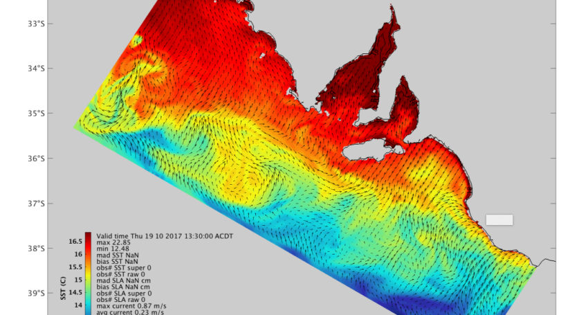
Ocean mapping system developed in South Australia to provide real-time ocean forecasts to fishers and emergency services.

Sign up to receive notifications about new stories in this category.
Thank you for subscribing to story notifications.

The mapping system, available through the eSA-Marine website, uses real-time satellite data to monitor sea level, wind direction and ocean currents for the entire south coast of Australia.
The forecast technology was developed by researchers from the South Australian Research and Development Institute (SARDI) in partnership with the Bureau of Meteorology and the University of Adelaide.
SARDI researcher Professor John Middleton, who likens the eSA-Marine to a weather forecast, said the Bureau of Meteorology were looking for partners and recognised that SARDI had the skills and the models to develop a forecasting system.
“Each day the Bureau of Meteorology produce a forecast for today and tomorrow and so on. Those forecasts give estimates of wind speeds, directions and also temperature,” said Professor Middleton.
“The bureau provides those forecasts so people can plan ahead. What we’ve done is develop an entirely similar system, but for the ocean, which includes the gulfs and the shelves. This system gives a forecast everyday for what will happen today and up to two days in advance.”
South Australian Minister for Agriculture, Food and Fisheries, Leon Bignell, says the technology is a big step up from manual monitoring techniques like drift cards.
“Now with the eSA-Marine website we can predict how extreme weather conditions will affect the ocean, track pathogens and pollutants and even help with search and rescue efforts,” said Bignell.
The free site can be used by anyone wanting information on ocean conditions, including recreational fishers, surfers and boaters.
Professor Middleton said the technology is one of only two in-shore ocean data assimilating forecast systems in Australia, with the other one used for to monitor the Great Barrier Reef.
“It’s got a multitude of uses, one is for example fisheries and agriculture, including Bluefin tuna industry. During December through to February, the juvenile Bluefin tuna migrate through the Australian Bight in water temperatures ranging from 18 to 21 degrees,” he said.
“If we can tell the industry where that water is, they can better focus their fishing efforts and reduce their costs.”
Australian Southern Bluefin Tuna Industry Association CEO Brian Jeffries said the technology will predominantly aid fishermen in the Great Australian Bight navigate the rough weather.
“Fishing each year in the Great Australian Bight is made difficult by the huge size of the Bight, the rough weather and tuna moving all the time in water temperature fronts,” said Jeffries.
“The eSA-Marine technology and high service quality gives us the capacity to target particular fish sizes and use a lot less fuel.”
Professor Middleton said another possible use for the eSA-Marine is to alert fisheries of contamination.
“Another use which is also of interest to the fisheries and agriculture industry, including the oyster industry, is the possible directions of pathogens and harmful algal blooms and toxins,” he said.
“As we can predict currents, we can predict where the blooms might go and we’re actively working with personnel and bio-security on scenario studies for those sorts of events. If you know that one of the blooms will come towards your Kingfish pen for example, you can move it out of the way.”
Jump to next article


