New survey data to bolster Australian mining
Mining & Resources
Updated data from one of the world’s largest airborne geophysical imaging programs is set to improve mining opportunities in South Australia.

Sign up to receive notifications about new stories in this category.
Thank you for subscribing to story notifications.
The final data from the Gawler Craton Airborne Survey (GCAS) has been released, which will be used to improve exploration opportunities in the area.
The data packages include new merged magnetic, radiometric and elevation data and images.
Yvette Poudjom Djomani, member of the project group and Senior Geophysicist at Geoscience Australia says this data release will be a significant help in the next stages of South Australian resource exploration.
“The GCAS data is higher resolution than the previous geophysical data in the region,” she said.
“The new data will help refine geological interpretation by highlighting more features which were not seen in previous data packages.
“Refining the geological interpretation can lead to the discovery of new mineral resources.”
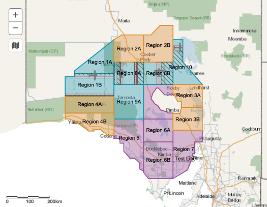
Gawler Survey Map
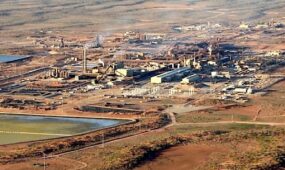
The Gawler Craton, in the centre of South Australia, is known for being one of the country’s leading exploration destinations, hosting Olympic Dam, which is the world’s largest uranium deposit.
Exploration of the craton is complicated, as a significant area is covered by thick layers of regolith, sediment and volcanic material.
Data from the GCAS will provide greater certainty in understanding the Gawler Craton’s geological structure, and will lead to enhanced exploration opportunities.
It will create a single, consistent dataset to reassess the formation of the craton, superseding patchy historical surveys.
The GCAS contracted four different surveying companies, which used fixed-wing aircraft to capture data. The aircraft travelled 60 metres above the ground, along flight lines 200 metres apart to collect the region’s geophysical information.
The South Australian Department for Energy and Mining partnered with Geoscience Australia in 2017 to undertake the survey, which in total captured over 1.8 million line kilometres of data over an area of 324,000 square kilometres.
The data can be downloaded directly through the SA Government’s SARIG database, which provides access to South Australia’s key geoscience information.
Jump to next article